
As a group, we have selected an area (based around Scarborough) which we regard as our ‘local patch’. We take a particular interest in the wildlife seen in this area and are always happy to hear from anyone who has sightings to share.
The ‘Scarborough District’ is defined in the rules of the Society using the Ordnance Survey six‑figure National Grid system:
• From a point just South of Whitby — NZ 930100
• South along the coast to Flamborough Head — TA 256700
• Due West inland to a point SE of Malton — SE 800700
• North in a straight line (West of Newtondale) to a point South of Ugthorpe — NZ 800100
• Then East back to the coast just South of Whitby — NZ 930100
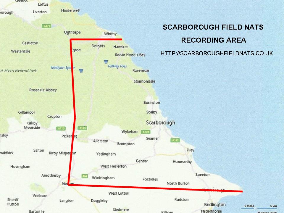
Note: The bold line indicates the boundary between Vice Counties VC61 (South) and VC62 (North).